ArcGIS Online
Can ArcGIS Online handle addresses or city names, in addition to latitude and longitude data?
Yes, ArcGIS Online can import addresses, or city names. Per Esri, “Depending on the geographic region of your organization, address data can be comprised of any of the following: address, neighborhood, city, subregion, region, state, province, postal code, United States ZIP Code, country, and so on” (source: Location types).
If using city names, you will need to restrict the layer to one country only as you import it, as ArcGIS Online asks you to choose a country. You will need to tell ArcGIS Online which column contains the address or city information.
How do I create layers that can be updated periodically on my map?
You can do this using hosted layers. In order to create hosted feature layers, you must first request Publisher role permissions from ITS. Once you have these permissions on your account, you can create hosted feature layers that can be updated easily from within ArcGIS Online, to push out updates to maps. Find out more information about hosted layers and how to create them at https://doc.arcgis.com/en/arcgis-online/manage-data/hosted-web-layers.htm.
Can you pull in data from Google Sheets?
If you have a Publisher account, you can pull in data from Google Sheets as a hosted feature layers and manually sync it to push updates. Follow these instructions from Esri for more information on how to do this.
If you do not have a Publisher account, you can pull in data from Google Sheets using the Classic Viewer in ArcGIS Online; it just won’t update automatically. You just need to publish it to the web as a CSV. You can then import it using the “Add Layer from Web” CSV File option.
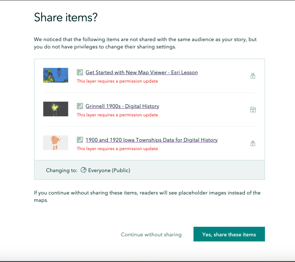
What sharing settings are needed to import a map into StoryMaps?
Your map sharing settings will need to have the same sharing settings as your StoryMap: when you go to publish your StoryMap, you will be prompted to publish any map content that is not visible at your desired sharing level, which you can do from within StoryMaps at the click of a button (see screenshot below).
How do blank data cells operate when mapped into ArcGIS Online?
It looks like points are still created for items in a layer whose attribute is blank. We are still playing around with how best to evidence something like this – it may be an issue of preparing the data in another way, rather than trying to evidence it from within ArcGIS Online. We would love to hear your thoughts if you play around with this!